
Lab 01: navigation: compass challenge
Migration
Part one:
- trace out a map of the big island
- using your phone in
progresscompass mode, take a sighting of at least three peaks you can identify on your huge map. - triangulate from there to your location
Part two:
- pick a place on your map that you need to be rescued from
- you have 1 minute of cel battery left, and your gps is not working
- calculate the angles you would see from this point to each of the major peaks on the island
- post your numbers on the whiteboard (or below) for the class to locate you
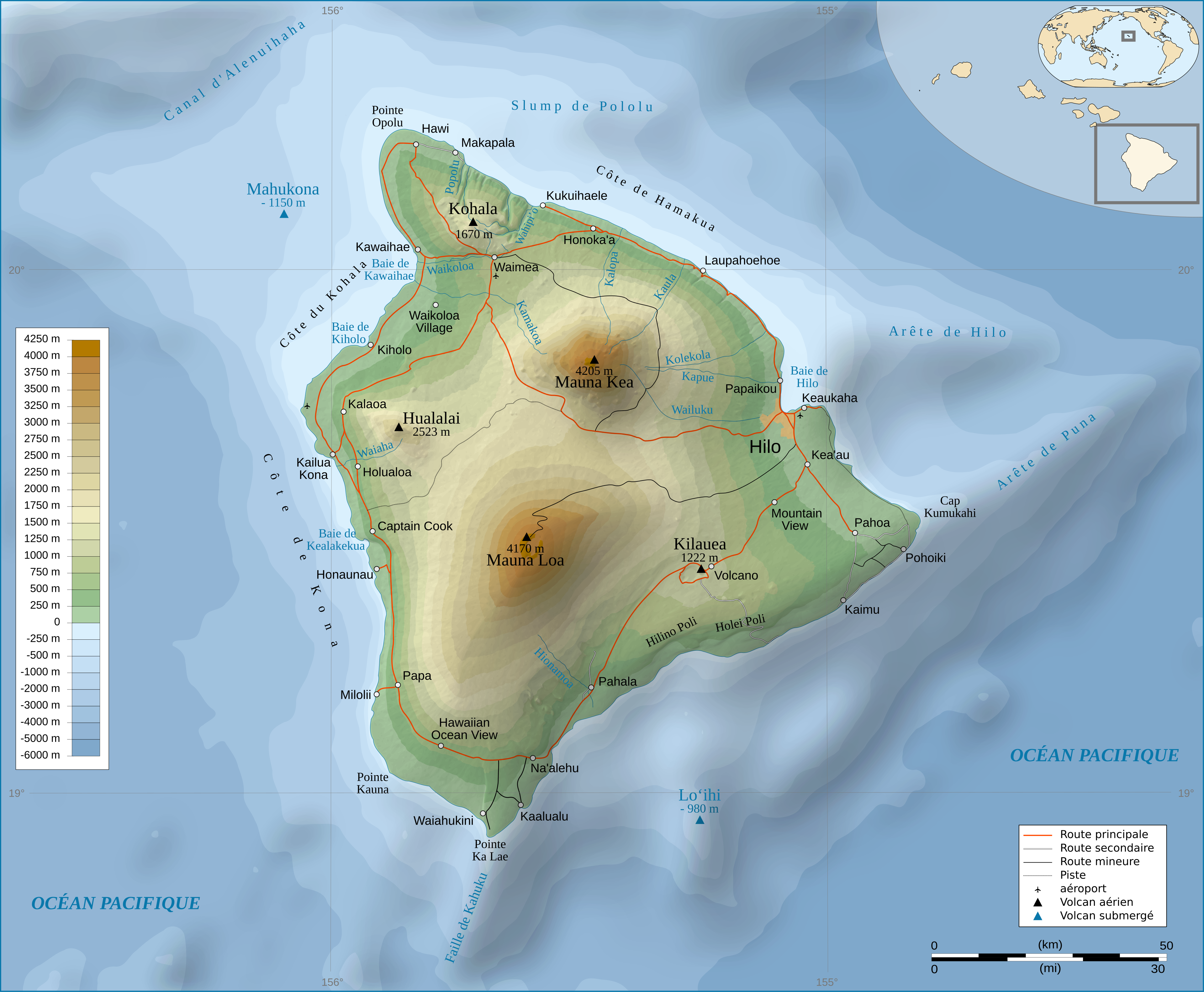
Mystery location:
Kohala 62°
Mauna Kea 123°
Mauna Loa 160°
Hualalai 181°
Migrated from Apple WikiServer Wiki. Original page U7x9h9U4B6.ID: U7x9h9U4B6