
Lab 11: earth: mapping earthquakes
MigrationPart 1: Shakenet
On your humongous map of the big island, we will be calculating the epicenter of earthquakes.
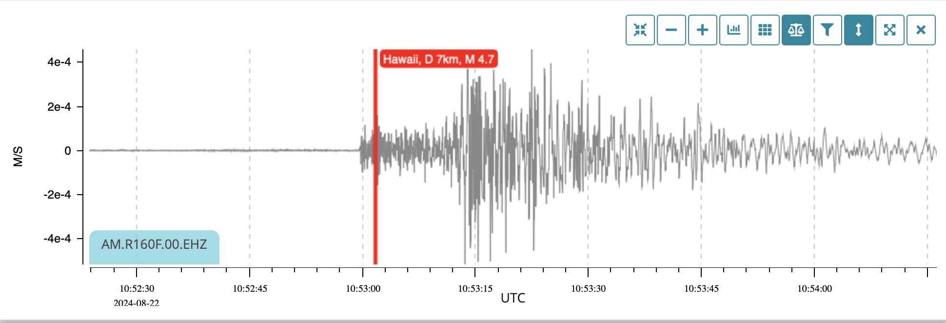
Here is an example of an earthquake measured by our seismic sensors (seismographs):
Terms:
- epicenter: the place on the surface above the quake
- hypocenter: the actual place under the surface where the quake occurred
- P wave: primary wave, a compression wave that travels fast, and can go through liquids (more on this soon)
- S wave: secondary (slower) wave, a transverse wave that cannot go through liquids
- Delay: for every second between P and S waves, you are 8 km from the quake
- You will also get to see a real-live quake sensor being built by Nick Winterowd from our ISR class
First, go here:
- Look at the stations, and pick one on our island
- On the right, you can select 24 hour view
- Look for a quake that happened recently
- Notice how spaced the front (P wave) and second part (S wave) are.
- Notice how far each station is from the red dot on the map that represents each quake.
- Calculate the distance from each station and draw a circle around it on your big big island map
- Determine the epicenter and hypocenter
Questions:
- why would the gap in
progressHilo be smaller than the one at HPA? - look up why it is important to know that only P waves travel through liquids
- how did the seismic network on the planet show us what the core of the earth is made of?
- who constructed this network and why?
- what is the Richter scale, and how much stronger is a 5.0 than a 4.0 quake?
- below is a report on a quake in Japan. Why are his numbers different from the normal velocities?
Part 2: Find the quake!
Study this map:
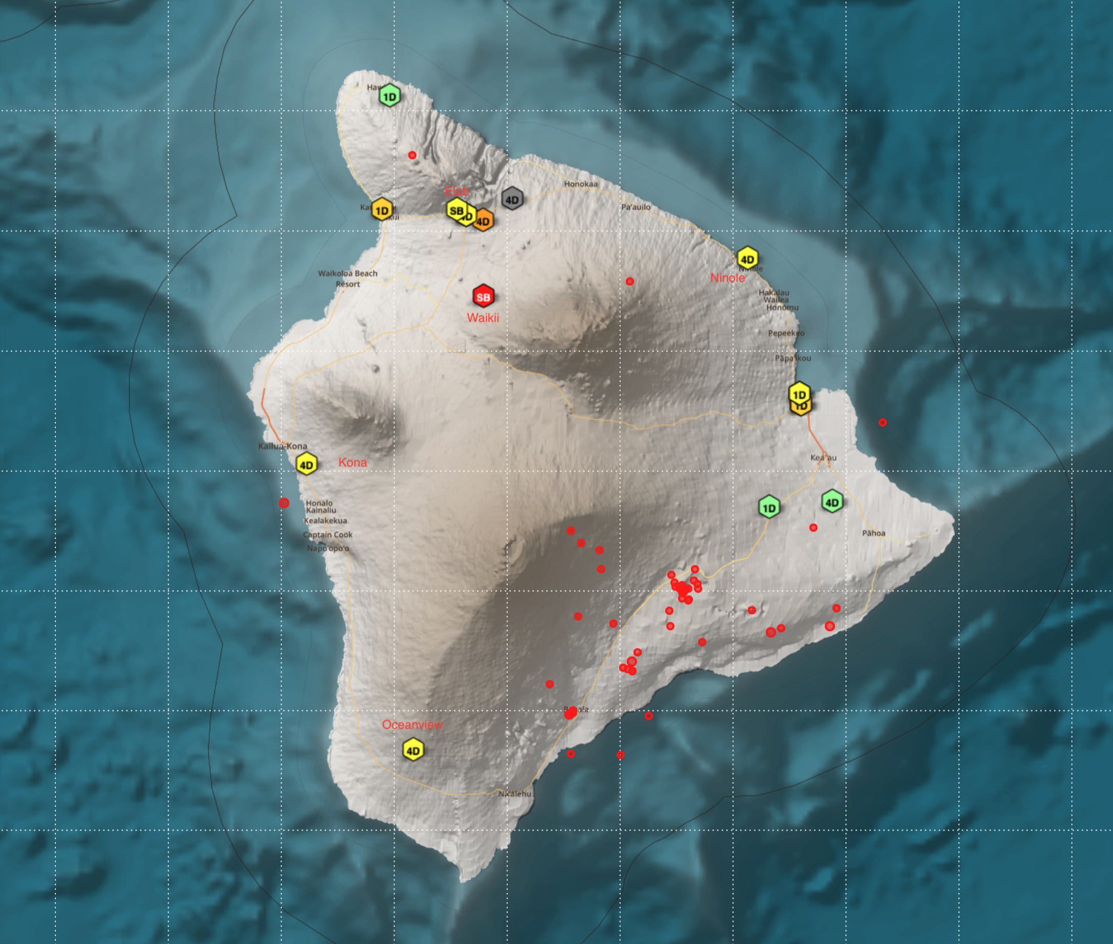
Your seismic stations are at the following locations:
Oceanview 4D
Kona 4D
Waikii SB
Ninole 4D
Elab SB
You will locate 4 actual earthquakes, some of them very large (7.0)
Each station records a P wave followed a few seconds later by an S wave
Knowing that for Appleevery Wikisecond the S wave is slower than the P wave, the quake is 8 km away
Find the location of each quake on your huge map
Clues:
One of these caused a power outage all over the state, another began a huge lava flow, another was on a supposedly dormant volcano, and another may be erupting today...
- one:
- Oceanview 4D 5.48
- Kona 4D 5.67
- Waikii SB 5.23
- Ninole 4D 8.4
- Elab SB 7.8
- two:
- Oceanview 4D 11.9
- Kona 4D 5.03
- Waikii SB 2.7
- Ninole 4D 8.83
- Elab SB 2.26
- three:
- Oceanview 4D 7.56
- Kona 4D 9.77
- Waikii SB 8.08
- Ninole 4D 7.44
- Elab SB 10.15
- four:
- Oceanview 4D 10.64
- Kona 4D 7.34
- Waikii SB 3.06
- Ninole 4D 4.08
- Elab SB 4.06
Part 3: your quake
Stage a quake somewhere on the island or offshore, and calculate the number of seconds separating the P and S waves.
Challenge your classmates to locate the quake with your name on it!
Local Quake!
- go here: https://stationview.raspberryshake.org/#/?lat=19.60360&lon=204.04469&zoom=9.442&sta=R277A
- find the stations on your map
- click on each of the stations, find the quake that happened at 2:33 AM in the morning, 24.9.25
- click the + key and measure the seconds between P and S waves:
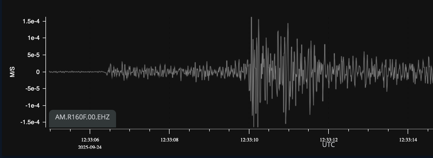
elab.png - use your awesome mapping skills to find the epicenter of the quake!
January 26,2026 quake 4.2 Pahala, depth 33 km
Surface distances:
- Ninole 87 km
- Kona 64 km
- Waikii 75 km
- Volcano 51 km
- Kawaihae 96 km
- elab 92 km
Migrated from Apple Server Wiki. Original page ID: A1F512W