
Lab 12: earth: biome hunt
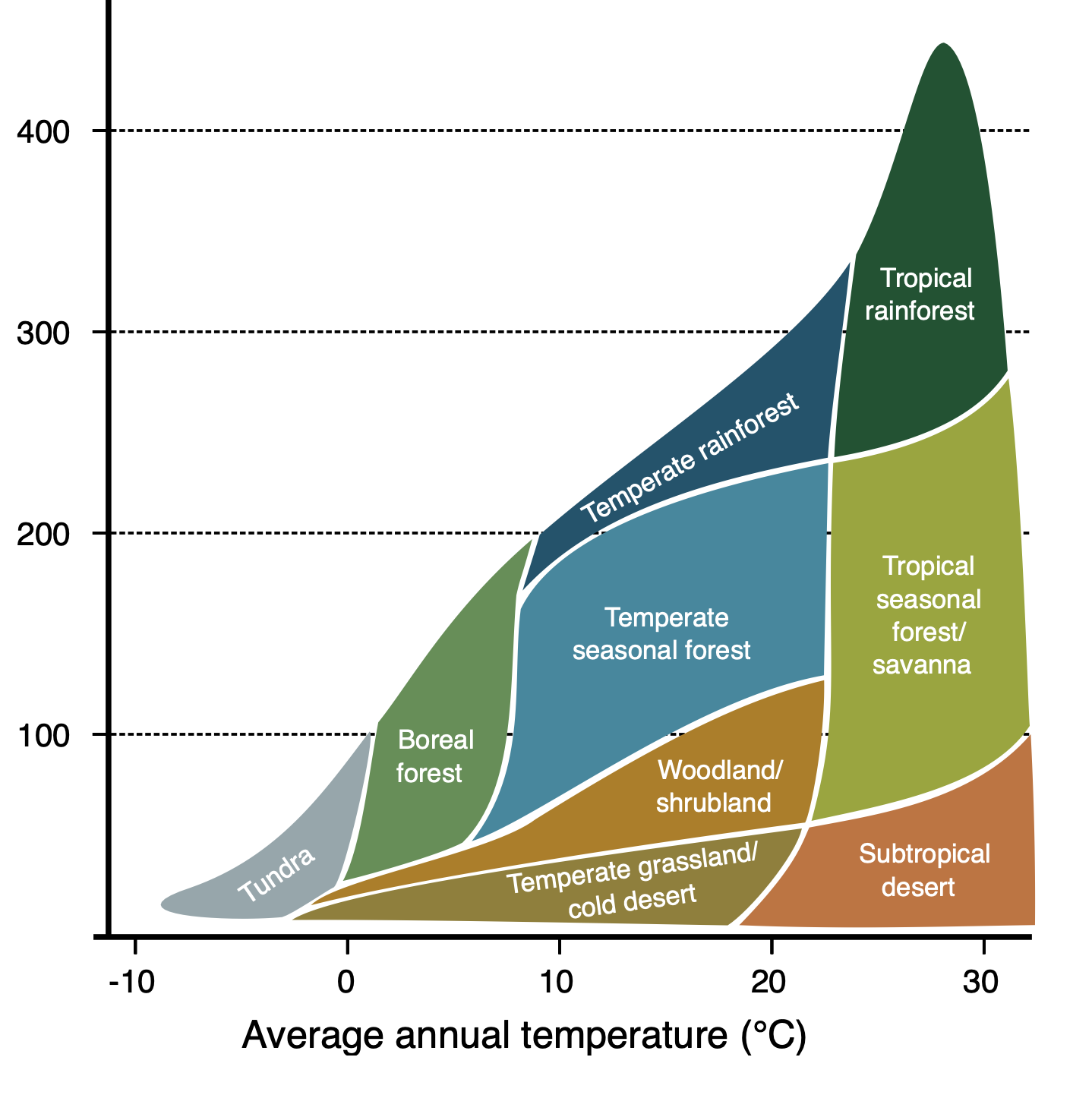
Biomes are a way of describing an environment based on rainfall, temperature and altitude, along with proximity to the ocean in our island case. In the diagram below, temperature is on the X axis, while rainfall is on the Y axis in mm of rain per year:
Part I Challenge: Island of Hawai'i
- Your challenge is to pick 8 random places on your island map, label them 1-8 and challenge your classmates to determine the biome in each location using only google earth and google street view.
Part II Challenge: Island chain-Hawai'i to Kauai
- Repeat your hunt for the entire island chain, from Kauai to our island with at least two different biomes for each island where possible (one island has only one biome)
- Your classmates will then identify the biome at each location
Part III Challenge: Global biomes
- Pick 8 random places on the globe and using the same tools challenge your classmates to name the biome for each place
Questions: email before next class
- what sort of biome tends to be on the southwest side of each island?
- what sort of biome tends to be on the northeast side of each island?
- which direction does the wind and rain come from most of the time?
- which island has only one biome and why?
- why does our island have so many more biomes than the others?
- where is the wettest place on earth?
- why?
- why is Waipio Valley so wet while Kawaihae is so dry?
- what seems to determine the biome on an island?
- what seems to determine the biome anywhere else?
Migrated from Apple Server Wiki. Original page ID: y6h4G5