
Lab 14a: earth: ahupua'a model
https://en.wikipedia.org/wiki/Ahupua%CA%BBa
On your huge big big island map, diagram the Ahupua'a between Waimea and Kona, including the Pelekane watershed.
Make sure to label each one clearly
Ask a friend from Kona to take photos of the Ahupua'a markers along Queen Kaahumanu Highway on the way to Waimea
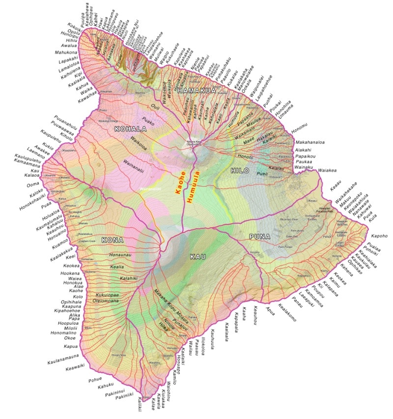
Questions: email for credit
- how does your work on biomes connect with the ahupua'a model?
- what is the difference between a watershed and an ahupua'a?
- why was this model so successful in maintaining a sustainable culture?
- what was the biggest ahupua'a on the island, and why?
- how did the great mahele impact this model? good or bad?
- how many markers can you see when you drive along the coast from Kona to Waimea?
- how has resort development impacted this system?
- what is the coast path known as in Hawaiian, and what was its function?
- what is the story of the city of refuge, and how did this promote social structure?
- why are there more on the Hamakua coast than on the Kona coast?
Migrated from Apple Server Wiki. Original page ID: m093f9K